Hello, Sign in
 Cart
Cart 


.svg)


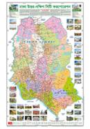

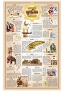
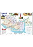
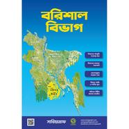
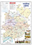
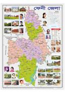
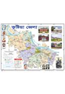
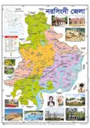
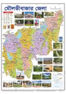
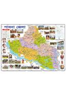
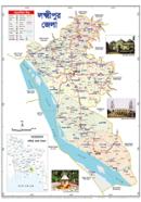
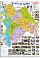
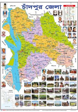
Sariyagraph Chandpur District Map provides a 47x63.5 cm layout for administrative navigation. Bangla text labels identify local boundaries across the Chittagong Division. Full-color printing differentiates Upazila borders and geographical features on a single sheet.
Key Features
- Bangla Labels: 100% vernacular text covers all administrative sectors. Native text aids rapid identification of local Upazilas.
- Paper Build: Heavyweight stock resists tearing under standard handling. Material withstands road dust and repeated unfolding.
- 47x63.5 cm Surface: 18.5 x 25-inch total area for wall or table mounting. Large scale shows the Meghna River confluence and Hilsa City markers.
- Foldable Format: Pre-creased paper collapses for transport or storage. Fits into standard bags without adding significant bulk.
Frequently Asked Questions
What is the size of Chandpur district map?
The map measures 47x63.5 cm, equivalent to 18.5 x 25 inches. This surface area displays the entire district grid on one paper sheet.
Where to buy Chandpur district map in BD?
Purchase this Sariyagraph edition through the Rokomari platform. It ships to all administrative zones within the country.